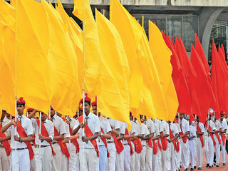
Today is Karnataka Rajyotsava, a day celebrating the formation of the state in 1956. ‘One State, Many Worlds’ best describes our story, marked by a unification despite the pulls and pressures of socio-linguistic fragmentation
There is not a day on which Kannada, the state language of Karnataka, comes into popular focus more than every November 1. The day marked as Karnataka Rajyotsava, a public holiday, has been typically accompanied by visual symbols everywhere, of the state’s identity – like buntings of an (unofficial) flag and banners about an (official) language.
Translated literally to ‘State Festival’, Rajyotsava marks the day in 1956 when the erstwhile Mysore State was expanded to re-unify into it, some key Kannada-speaking and geographically connected regions of South India. The change of the State’s official name to Karnataka itself happened close to two decades later, with the passing of the Mysore State (Alteration of Name) Act, 1973.
The early C(K)arnatic
The term ‘re-unification’ of the State needs to be understood with some historical context. The geo-political expansion of the region had been commenced by Chikka Devaraka Wodeyar and continued by Hyder Ali, which towards the end encompassed a surprising area compared to what Karnataka State is today.
This growth of the Mysorean region was of course cut short by two key events: The Treaty of Seringapatam (1792) which ended the Third Anglo-Mysore War, and The Siege of Seringapatam (1799) which ended the Fourth Anglo-Mysore War.
The result of the former was that, about half of the Mysorean territory, was divided by the British and their allies at the time – the Mahratta Peshwa acquired territories up to the Tungabhadra River, and the Nizam of Hyderabad was granted land between the Krishna and Pennar Rivers, and the forts of Cuddapah and Gandikota. The East India Company itself retained a large integral central portion (Mysore and Coorg) and some of the Malabar Coast territories between Travancore and the Kali River, as also Baramahal and Dindigul districts. The result of the latter, which marked the final confrontation between the East India Company and the Kingdom of Mysore, was a further division of the remaining parts of the kingdom – Kanara, Wyanad, Coimbatore, Dharmapuri and Srirangapatna were retained by the British and the Nizam acquired Gooty, a part of Chittoor and Chitradurga districts. The effect on the ground was that large pockets of people were placed outside the core Mysore region, but still retained Kannada as lingua franca because of continued trade and commerce across the borders of a larger core region.
Karnataka in focus
The implication of the States Reorganisation Act of 1956 for the Kannada speaking regions at that time was of course, the re-unification of some zones that had been separated over a hundred years earlier, and the merger of other zones that were inherently Kannada speaking but were part of historical empires that had held on to them over time.
Remarkably, the name indicated by the States Reorganisation Committee for the unified state was “Karnataka”. The committee’s report provides explanatory notes
as to why the state was not proposed to be divided into two (keeping the erstwhile Mysore State separate, as was demanded by a school of thought at that time), and Section 329, which clearly states, “For these reasons, we recommend that one Karnataka State should be formed. This state should, in our opinion, comprise the, following areas…” and lists the areas proposed for unification covering the then existing Mysore State, four Kannada-speaking districts of the southern division of Bombay, namely, Belgaum, Bijapur, Dharwar and North Kanara, two districts from the princely state of Hyderabad namely Raichur and Gulbarga, South Kanara, Kollegal from Madras, and Coorg.
There were some exclusions in the recommendations, such as Bellary and Hospet taluks, as well as Kasargod, and further explanations were provided with a note “The territorial limits of Karnataka, as thus proposed, broadly cover the Kannada-speaking areas, but in the case of one or two small units, linguistic considerations have been subordinated to other compelling reasons”. The report also mentions Kolar district as an inclusion despite having a majority of Telugu speakers, for reasons of historical interest of Mysore in its industry as well as proximity to Bangalore versus Kurnool or Hyderabad. It also provides a list of over a dozen additional justifications for inclusions, exclusions, economic considerations, developmental and industrial issues, natural resources, population and administration. Finally, in Section 351, the report makes a defining statement: “Karnataka with the territorial limits which have been indicated so far will have linguistic and cultural homogeneity and geographical integrity. Barring a few dissentients, all those who have been concerned with the Karnataka problem in some form or (Aber will sooner or later recognise that this is so…”
Despite the recommended name in the SRC Report, the name of the expanded State was retained as Mysore in the SRA of 1956. Two decades later, with the passing of the Mysore State (Alteration of Name) Act, 1973, the erstwhile Mysore State officially adopted the name of Karnataka. This was in itself also due to an identity conflict where residents of northern Karnataka felt the name of Mysore reflected only the erstwhile regime, and did not represent the expanded state. Prior to the unification of Gulbarga, Raichur, Bidar and Koppal districts, the High Court jurisdiction was Hyderabad, only 200 km away, but after the unification it had moved to Bangalore, at four times the distance.
(The author is an IT professional and Bengaluru heritage enthusiast)
source: http://www.bangaloremirror.indiatimes.com / Bangalore Mirror / Home> Bangalore> Others / by Kiran Natarajan / Bangalore Mirror Bureau / November 01st, 2017
